Did you know Anglesey is home to the second-largest fenland in the UK? These unique and rare habitats store up to eight times more carbon than a rainforest of the same size, playing a vital role in fighting climate change. But the future of these special places and the cultural heritage they hold is at risk.
Corsydd Calon Môn is a collaborative project that aims to secure the future of the Anglesey Fens and celebrate their rich history.
What will the project do?
Working together with farmers, landowners, heritage groups, schools and local communities, we will:
- raise awareness of the importance of the fens for both people and nature.
- support local farms with sustainable practices that build resilience and protect land and livelihoods for future generations.
- explore and record the heritage of the fens, celebrating the culture and history embedded in the landscape.
- improve the health of existing fenland habitats and create stronger connections between them for more resilient ecosystems.
- make sites more accessible so that more people can experience and enjoy them.
- provide opportunities for volunteering, skills training, and community well-being activities
Who is involved?
Corsydd Calon Môn is a partnership between North Wales Wildlife Trust, Natural Resources Wales, Dŵr Cymru, Farmers Union Wales, National Farmers Union Cymru, Menter Môn and Betsi Cadwaladr University Health Board.
How is the project funded?
Corsydd Calon Môn is funded thanks to lottery players through the National Lottery Heritage Fund, with additional funds to support the project from the Esmée Fairbairn Foundation.
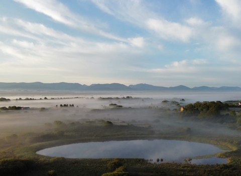
Aerial image of Cors Goch by Roy and Tracy Briggs.

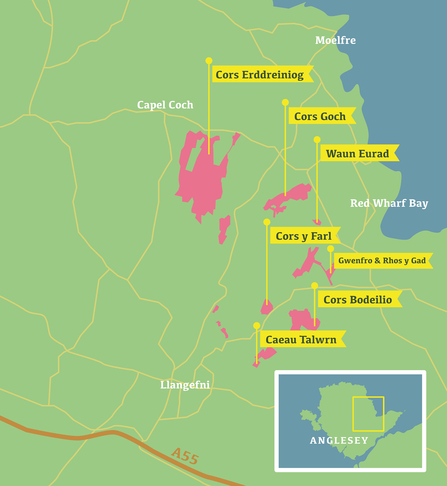
Anglesey Fens Key Sites - Matt Canning


